


Advanced Drone Data Collection
Fast-paced industries can no longer rely on traditional methods for gathering information. Using drones allows teams to collect critical insights quickly and safely through drone data collection. Properly processed, this information helps improve decision-making, efficiency, and overall operational performance.
What Is Electronic Data Collection
Electronic Data Collection (EDC) is a digital way to record, share, store, and analyze information instead of using paper forms. When drones are used with EDC, they can quickly capture high-quality aerial data photos, infrared readings, LiDAR, and location details—which is then stored securely and processed for faster insights and better decisions.
Challenges in Traditional Data Collection
- Data collection that takes a long time: Old method take a long time and put off important choices.
- There is a high chance of making a mistake: When you work by hand, you often make mistakes, leave out important information, and get uneven results.
- Areas that are unsafe and hard to get to: Collecting data in places that are far away or dangerous puts workers in danger.
- Reports that come in late: Data is often hard to find and takes a long time to process, which lowers trust and accuracy.
- Costs of doing business are high: More work, equipment, and visits that happen often raise costs without adding clear value to them.
How ZenaDrone solves these challenges
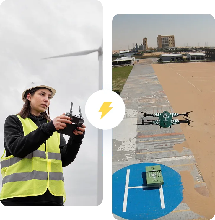
ZenaDrone uses intelligent drones to collect accurate data during automated flight , flight missions, providing reliable and repeatable results every time. High-quality imaging and sensors record clear details of inspections and measurements. Guess what? The rapid transmission of data enables teams to review and act on information immediately. The system , system is designed to scale easily, supporting everything from single-site operations to enterprise and government deployments.
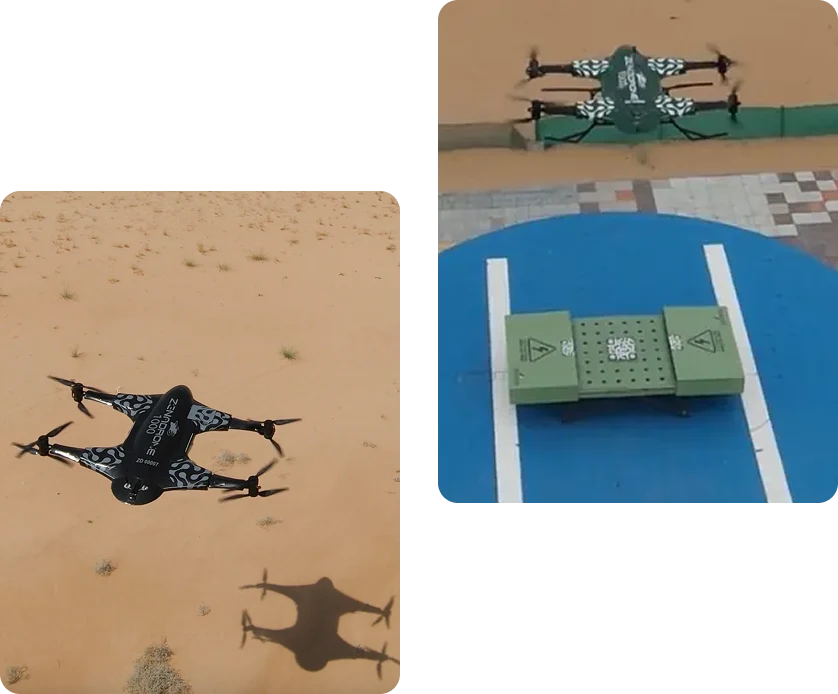
AERIAL PHOTOGRAPHY SERVICES
ZenaDrone provides high-quality aerial photography that gives you a clear, detailed view of your site, project or property. Like, Drone imagery allows teams to see more, plan better, and document progress with confidence.You know what?
- Documentation of the tools: Clear visual capture of buildings, facilities and infrastructure.
- Track your progress: Track project changes over time with consistent aerial imagery.
- Marketing materials: High-quality visual elements that highlight properties and projects.
- Insurance documentation: Reliable visual evidence to support claims and risk assessments.
- Site planning: Full aerial photography to support future design and development.
Technical Excellence
Our aerial photography services are designed for accuracy, cleanliness, and reliability.
- High-resolution cameras provide clear, detailed images
- Stable flight control provides accurate and consistent framing
- Advanced stabilization ensures smooth, clear images
- Multiple lens options capture wide, close-up, and detailed views
- Professional image processing improves overall quality
- Secure digital delivery keeps your data safe and accessible

Benefits of ZenaDrone Electronic Data Collection
- Faster Data Acquisition: The time used for data collection can be cut by as much as 70%. Consequently, the project schedules and decision-making processes are accelerated.
- Higher Accuracy: Automation erases human mistakes that normally accompany manual data collection. The sophisticated UAV data processing can’t only provide very precise but also very consistent results.
- Cost Efficiency: Drone-driven processes reduce the costs significantly associated with labor, equipment, and travel. All these expenses can be minimized while achieving increased efficiency in operations.
- Real-time Insights: The immediate access to processed data supports the faster data-driven decisions across several departments.
- Scalable Deployment: ZenaDrone technology is ideal for local projects as well as for large-scale corporate operations that are spread out over several areas.
Industry-Specific Applications

Agriculture
- Crop health monitoring and analysis
- Soil condition assessment
- Irrigation system inspection
- Full-season crop growth monitoring
Construction
- Site data collection and documentation
- Construction timeline monitoring
- Volumetric measurements (cut/fill analysis)
- Mapping and site modeling

Utilities & Energy
- Asset inspection and condition monitoring
- Power grid inspection and monitoring
- Pipeline inspection and assessment
- Preventive maintenance planning

Infrastructure & Smart Cities
- Road and bridge inspection
- Urban planning and development analysis
- Construction progress tracking
- City infrastructure monitoring

Defense & Security
- Secure aerial surveillance
- Situational awareness and reconnaissance
- Risk assessment and threat monitoring
- Mission planning and operational support

Environmental Monitoring
- Land surveying and mapping
- Habitat and wildlife monitoring
- Environmental impact assessment
- Long-term environmental analysis
WHY CHOOSE ZENADRONE?
Industries don’t settle for less. They ask for nothing but technology that is accurate, reliable, and performing at a higher level. The capability of ZenaDrone to meet the detailed demands of vast and highly controlled areas has been demonstrated in our corporate and government partnerships.
Various industry certifications and the strictest compliance regulations form the foundation for ZenaDrone, as we adhere to global safety, data protection, and operational excellence standards. The data’s integrity is preserved from the beginning to the end of the data processing lifecycle. This is achieved by processing data from start to finish, enabling ZenaDrone to deliver proven and consistent performance across various industries, ranging from agriculture to military applications.
How does drone-based electronic data collection work?
Drones are enabled to capture aerial data automatically with the help of advanced sensors. The data gets transferred, processed, and analyzed through secure platforms that provide insights that can be acted upon.
Is drone data collection secure?
Yes. ZenaDrone adopts secure communication, reliable cloud computing, and top-notch access controls for handling drone data, which are all great features of an enterprise.
Which industries benefit the most from electronic data collection?
Agriculture, construction, energy, infrastructure, defense, and environmental monitoring.
How to Extract Data from a Drone?
Data is extracted using integrated software platforms that support automated uploads, structured analysis workflows, and advanced processing tools.
How to do a drone survey?
Drone survey encompasses the process of mission planning, autonomous flight execution, advanced data capture, and specialist tools to analyze drone data for the post-flight.
Can ZenaDrone customize data collection solutions?
Yes. ZenaDrone provides completely adjustable electronic data gathering solutions which are designed according to the specific needs and operational targets of different industries.
Book a Demo
See how the ZenaDrone IQ Square operates firsthand! Please complete the form, and our team will contact you for a demo schedule.
Thank you for your message. It has been sent.