


Drones for Fire Departments and Complete Guide
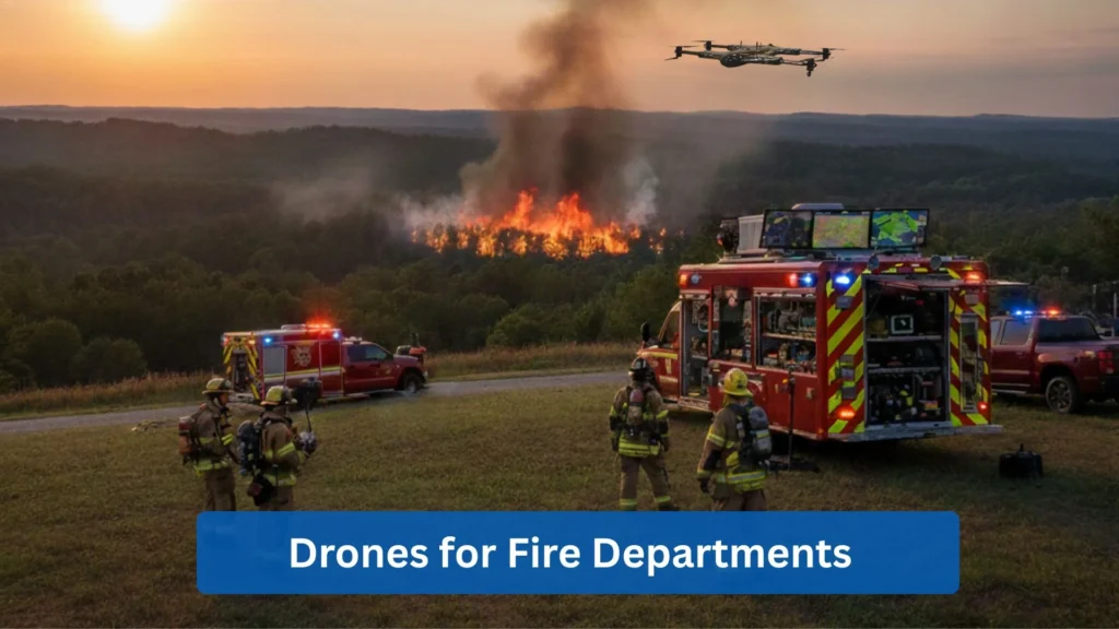
Firefighting units encounter many complex emergencies, from urban and wildfires to incidents involving hazardous materials. Fire department drones have been one of the greatest innovations as they provide aerial images in real-time while ensuring safety.
This article will discuss the different ways in which drones are being utilized by fire departments, their advantages, and the necessary regulations.
What Is a Fire Department Drone?
A fire department drone is basically a drone that is deployed for fire and rescue incidents. This device is equipped with advanced tools such as thermal and high-resolution cameras and GPS, giving rescuers a real-time aerial view.
Drones are deployed to locate hotspots and people, as well as assess damage, allowing firefighters to determine hazards beyond the smoke. The data collected will then be developed into a 3D map and high-detail imagery for post-incident analysis.
How Fire Department Drones Differ From Standard Drones
Although standard drones and fire department drones share the same flight principles, drones used in fire departments are built for harsh situations. Here are the key differences between the two:
- Environmental Resilience: Fire department drones are built with materials and sealed systems that enable them to withstand harsh conditions. These include high temperatures, high humidity, corrosive salt air, or heavy smoke concentration.
- Specialized and Redundant Payloads: Firefighting drones have built-in redundant systems. Extra controllers and backup systems prevent drones from crashing due to battery failure.
- Extended Range and Flight Time: High-capacity batteries allow for longer flight times. Meanwhile, flight optimization software helps drones avoid electromagnetic interference.
Why Fire Departments Are Increasing Drone Adoption
The adoption by fire departments to utilize drones is due to their advantages in terms of safety, effectiveness, and return on investment.
- Immediate Aerial View: It offers a cost-effective way of accessing an immediate aerial point of view in comparison to a crewed aircraft.
- Sustained Flight: They can idle over an area at a low altitude for extended periods without the risk of harm and over-consumption of fuel.
- Reduced Cost: It significantly cuts down on operational costs for fuel, maintenance, and pilot hours that are usually utilized on crewed aircraft.
Benefits of Fire Department Drones
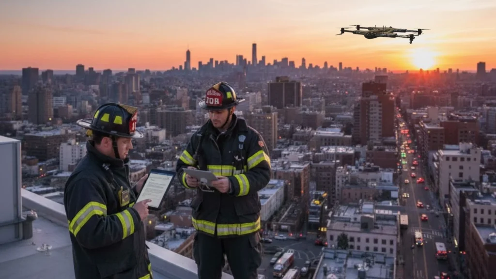
Improved Situational Awareness
A fire department drone can provide the Incident Commander (IC) with an aerial view of the scene in a short span of time. It cuts down the time spent performing the initial assessment phase of an incident.
- Scale and Scope: immediately assess the extent and location of the fire.
- Safety: fast tracking of trapped victims and escape routes.
- Hazard Identification: locating utilities that might cause explosions, like gas meters, power lines, stored chemicals, or vehicles.
- Resource Staging: determining safe access routes for rescue and apparatus.
Reduced Risk for Firefighters
With the drone’s ability to enter hazardous areas and provide an aerial view, it prevents firefighters from entering unknown or unassessed dangerous regions.
- Pre-Entry Assessment: early detection of hidden dangers like pressurized tanks or hazardous materials before entry with the utilization of thermal imaging.
- Overmatch: provides real-time monitoring of operations, allowing quick operational decisions for changes in fire conditions.
- Reduced Physical Strain: It reduces physical strain and exhaustion on responders during search and rescue operations.
Improved Incident Command Support
Fire department drones provide a real-time aerial view of the situation during emergencies. They empower Incident Command Systems (ICS) to adapt and be more flexible.
- Dynamic Resource Allocation: ICs can dynamically redirect resources to locations where they are most effective by assessing them through the live video feed.
- Multi-Agency Coordination and Common Operating Picture (COP): ensures all entities operate the same by streaming through the live video feeds. This live video feed is streamed to the Emergency Operations Center (EOC) and shared with local law enforcement, utility companies, public works, and other cooperating agencies.
- Tactical Documentation: Drones provide important documentation data crucial for post-incident reviews, training, and legal compliance. This critical documentation can include evidence of scene conditions, resource placement, and incident evolution.
Cost-Effective Aerial Operations
Transitioning to drone operations requires an initial investment. However, the long-term operational cost for drones is minor compared to crewed air support.
- Low Operational Cost: Drone missions require a certified pilot, battery consumption, and minimal maintenance. In contrast to a crewed aircraft, it consumes an hourly fuel consumption, a flight crew, and high maintenance costs.
- Immediate Availability: Crewed aircraft deployment can be on hold due to pilot requirements, daylight hours, and maintenance issues. Drones, on the other hand, can be deployed 24/7, limited only by weather situations.
Fire Department Drone Policy: Building a Safe & Compliant Program
The core of successful incorporation of drones in the fire department is to implement a fire department drone policy. This policy will ensure strict legal compliance, operational safety, and public trust.
FAA Compliance & Pilot Certification
Compliance with the regulations of the Federal Aviation Administration (FAA) is obligatory for every public safety agency that operates drones in the U.S.
- Part 107 Remote Pilot Certification: Pilots must acquire an FAA Part 107 Remote Pilot Certificate before flying a drone.
- Public Aircraft Operations (PAO) Status: Fire brigades often operate under a Certificate of Authorization (COA) issued by the FAA, which designates them as a Public Aircraft Operations.
Airspace & Operational Rules
Any department’s drones should have clear and documented protocols regarding flying locations, timings, and processes.
- Controlled Airspace Authorization: Strict procedures will govern the process of getting quick permission to operate in controlled airspace, which will usually be near airports.
- Waiver Management: There should be a clear policy that states the process for requesting and utilizing operational waivers. Such as flying over non-participating people, at night (beyond the standard Part 107 night allowance), or beyond visual line of sight (BVLOS).
SOPs for Deployment, Storage & Data Handling
- Deployment Criteria and Checklist: Specific incidents like 3-alarm fires, technical rescues, and hazmat incidents where deployment is mandatory or recommended. Implement a pre-flight and post-flight checklist for security.
- Secure Storage and Maintenance: Maintain detailed logs of flight hours and maintenance routines. Drones, payload sensors, and batteries must be kept in a safe place when not in use.
- Chain of Custody for Data: Create distinct, legally defensible protocols for the secure acquisition, storage, retention, backup, and eventual release of video and photo evidence. Data must be handled with the same rigor as body camera footage.
Training Requirements & Risk Management
Proper training and consistent evaluation ensure that drone pilots are at their best during emergencies.
- Mandatory Training: Implement a comprehensive training curriculum that covers basic aviation principles, thermal imaging interpretation, scenario-based flight practice (simulated smoke, low light), and ICS integration.
- Crew Resource Management (CRM): Applying CRM principles, considering the drone pilot and visual observer (VO) as a two-person flight crew. Reducing human error and guaranteeing uninterrupted focus on the aircraft and the airspace.
Creating a Department-Wide Drone Governance Plan
- Command Structure and Authority: Create a clear structure and flow on who takes charge of drone deployments and how the data is delivered to the appropriate personnel. Doing so avoids confusion and conflict on orders.
- Transparency and Public Communication: A coherent strategy is essential when communicating the drone program’s public safety, policies on public interaction, and guidelines regarding privacy and collection.
7 Ways Fire Departments Use Drones in the Field
The abilities and advantages that these drones offer have expanded their use beyond observation. Here are seven ways the fire department uses drones in the field.
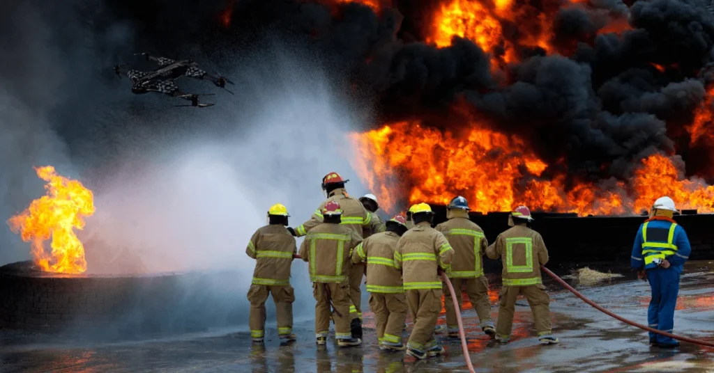
Fire Scene Reconnaissance
The initial flyover is the most significant drone mission. An aerial view from a drone provides an overview, determining the strategy approach for the incident.
It indicates the precise place of the fire, along with the spread path across a roof or a large building. This quick, comprehensive evaluation serves as the basis for the operation—offensive, defensive, and transitional.
Hotspot Detection with Thermal Imaging
- Seeing Through Smoke: Thermal imaging penetrates through thick smoke, allowing rescuers to detect victims and determine the severity of the fire.
- Overhaul Operations: The drone is used for thorough scanning of the building, spotting hot areas (hotspots) in walls, ceilings, or insulation. It helps control the water application and avoids incurring costs and dangers related to rekindling.
- Exposure Protection: the procedure of assessing the adjacent structures or exposures for heat transfer that may not be visible to the naked eye.
Wildfire Tracking and Mapping
- Perimeter Mapping: Custom software utilizes the drone’s GPS positioning data to combine real-time orthomosaic maps of the fire’s perimeter.
- Directing Resources: Guiding ground teams, and even the dropping of retardant from fixed-wing planes occupied by people, to the spots that are most critical.
Structural Fire Assessment
- Roof Assessment: Assessing the stability and soundness of a roof before fire crews are sent to do ventilation and fire rescue.
- Post-Disaster Vetting: In the aftermath of an incident, drones are equipped to fly very low and close to survey the area.
Search and Rescue Support
- Wide-Area Search: Quickly cover large areas that are very hard to reach or access, such as mountain paths, gullies, floodwaters, or coastline.
- Night Operations: Utilization of thermal imaging to detect the heat of a person.
Hazmat Incident Assessment
- Plume Tracking: entering a risky vapor cloud or chemical plume to determine the direction, density, and spread of the chemicals without putting Hazmat technicians at risk.
- Source Identification: determining the source of the fire through advanced chemical sensors or visual observation of tank labels or valves from a distance.
Post-Incident Reporting and Documentation
- Forensics and Investigation: creating 3D models along with aerial photography of the location for investigation of the fire origin and cause.
Real-World Examples of Fire Department Drone Programs Across the U.S.
U.S. fire departments have customized their unmanned aircraft system (UAS) programs based on their particular geographical, demographic, and hazard characteristics. The real-world applications demonstrate not only the versatility of the technology but also its necessity.
Austin Fire Department Drones
The Unmanned Aerial Systems Team, which refers to the Austin Fire Department’s drone unit, operates in very complicated environments. These environments consist of dense urban high-rises, large (Barton Creek Greenbelt) parklands, and considerable (Colorado River, lakes) water hazards.
Technical rescues, water emergencies, and high-rise structural assessments are the main areas where their drones provide support. AFD has made use of the drones for quick-to-the-spot deployment during sudden floods for locating people, including pre-deployment aerial intelligence and situational awareness during complex bomb threats or large gatherings. It has its efficiency in providing security intelligence in these situations.
Bedford Fire Department
The Bedford fire department drone program in Massachusetts serves as an example that drones can be affordable and up-scaled for smaller municipalities. They have planned to use drones in aerial support for routine structure fires and searching local forests for lost persons. The drone team of Bedford very often supports even small neighboring jurisdictions through mutual aid agreements. Becoming an essential force multiplier.
Chicago Fire Department Drone Unit
The unit of the Chicago fire department on drones operates through the extremely difficult conditions of hyper-dense urban areas.
CFD widely employs drones in giving external surveillance of great value during high-rise incidents. They observe outside conditions and monitor the speed and the color of the smoke from different floors, which is impossible from the ground level.
Fire Department Drone Use in Alabama
In Alabama, the drone programs of fire departments are primarily used by the Alabama Forestry Commission and local fire services, commonly used for surveillance and mapping of wildfires, which are the main threat in the rural areas of the state.
Houston Fire Department Drones
Houston Fire Department’s drones are critical for city-wide operations. They excel in handling large-scale emergencies and are used to survey, assess damage, conduct infrastructure checks, and direct rescuers in underwater neighborhoods.
Fire Department Drone Technology and Equipment
The basic functions of a fire department drone depend mainly on the high-tech specialized technology and the integrated equipment that it carries.
Drone Types (Quadcopters, Tethered, Fixed-Wing)
- Multirotors (Quadcopters/Hexacopters): The most typical ones for immediate tactical response; they come with hovering and precise movement capabilities.
- Tethered Drones: These facilitate continuous flight time at lower heights, which makes them perfect for the conduct of long-duration incident command posts.
- Fixed-Wing Drones: Their fast speed and long flight endurance make them suitable for large-area mapping (wildfires, disaster zones).
Thermal Cameras, Zoom Cameras & Specialty Sensors
- Thermal Imaging (FLIR): This technology helps see through smoke, finding victims, and detecting fire spread.
- High-Resolution Zoom Cameras: The camera gives close-up access to the inspection of structural components, license plates, or victims from a safe distance.
- Specialty Sensors: They consist of gas detection sensors for Hazmat incidents and LiDAR for detailed 3D mapping.
Real-Time Mapping & Live-Stream Tools
- Live Video Feeds: they consist of secure, low-latency video transmission to the Incident Command Post (ICP) and EOCs.
- On-Demand Mapping: a software that rapidly creates 2D maps or 3D models of the scene as the drone is flying.
Integrating Drone Data Into Command Systems
The programs that work best are those that insert drone data straight into the existing incident command systems (ICS). Allowing the overlaying of drone imagery and maps onto existing GIS data for thorough decision support.

Challenges Fire Departments Face With Drone Adoption
Despite the advantages of implementing drones in the fire department, there are challenges to overcome for it to be successful.
Budget and Resource Pull
- Initial Cost: Prices on specialized, multi-tasking drone platforms, thermal cameras, and the software are costly.
- Maintenance: It requires a sustained budgetary commitment for battery replacement, repairs, and software subscriptions.
Pilot Training and Certification Issues
- Staffing: It takes a lot of effort to hire and mentor employees who have the knowledge of both the fire industry and flying.
- Recurrent Training: Constantly ensuring recurrent flight training and staying updated with the rash changes of FAA rules.
Weather and Environmental Limitations
- Wind and Rain: Severe weather conditions may negatively affect the drone’s stability and safety, putting a stop to the operations.
- Extreme Heat/Smoke: High heat conditions and thick smoke can result in the drone’s system heating up and thus limiting its deployment.
Public Perception and Privacy Concerns
- Safety and Surveillance: There is a need to address concerns among the public about drones doing surveillance. Data security and privacy matter when flying over private property.
- Transparency: One of the ways to gain trust from the community is by being transparent about the drone program’s public safety mission.
The Future of Fire Department Drones
The utilization of drones is expanding, transforming emergency response in the near future.
AI-Powered Fire Behavior Prediction
The incorporation of onboard Artificial Intelligence (AI) for processing thermal imaging data and determining the rate of fire spread. Thus, it helps facilitate the real-time prediction of the fire’s spread path.
Drone Swarms for Wildfire Containment
Carry out drone swarms for the rapid mapping of large areas, dropping of sensors, and the deployment of fire-retardant packets.
Heavy-Lift Fire Suppression Drones
Creating drones capable of lifting heavy-dispatch to maintain and accurately deposit water or fire suppressants. Allowing the dispatching of fire suppressants in areas too hazardous or out of reach for a crewed aircraft.
Automation and Autonomous Patrol Routes
The programming of drones to perform like humans in the patrolling of high-risk zones (e.g., industrial areas, places with high wildfire risk). And the ability to take over the deployment and alerting of the command staff through the automatic detection of anomalies.
Conclusion
The integration of drones marks a significant, revolutionary move for fire and rescue services. It’s no longer just a gadget, but an essential tool for human safety. Providing a different perspective that significantly lowers the danger, speeds up understanding of the situation, and personnel data.
A fire department drone program shall consist of the three pillars: modern technology, strict adherence to FAA regulations, and a strong commitment to openness and community trust. Fire departments that responsibly adopt this technology are not only dealing with emergencies but also foreseeing and controlling them.
Contact Us
Thank you for your message. It has been sent.