


Mining Surveying Techniques: From Traditional to High-Tech Approaches
Mining surveying is one of the essential processes for exploration activities and efficient resource management. Providing accurate data on an area’s geology allows companies to make informed decisions about where best to locate their operations, how much mineral they have available, and what potential hazards are present in the vicinity. With the proper techniques and experienced professionals, making the most of available resources and maximizing profits is possible. And with the advancement of technology, mining companies have already upgraded their technique in making this work operation. In this blog, learn more about surveying for the mining industry and how important this job is.
Getting to Know Mineral Exploration
Mineral exploration is identifying and assessing potential areas for mineral extraction. It involves researching, mapping, and surveying an area of land to determine if it contains exploitable deposits of minerals or resources. Exploration typically begins with geological studies identifying features such as ore bodies, faults, or other structures that may contain valuable minerals. Surveying techniques such as aerial mapping and drone surveys help to map out the target area in more detail.
Exploration is an integral part of the mineral extraction process. It helps identify potential mining sites for maximum development and returns on investment. Mineral exploration typically comes with considerable risks, so companies must carefully assess potential areas before committing resources.
What is Mining Surveying?
Mining surveying is an essential technique in mineral exploration and aerial mapping. It involves using remote sensing and ground-based measurements to determine mineral deposits’ location, size, shape, and orientation.
Detailed surveys make it possible to accurately measure ore bodies that are difficult or impossible to access. Mining companies can utilize the gathered information for efficient resource management, economic evaluation, and legal filings. Mining surveying also provides valuable data on the subsurface geology, which can help identify areas suitable for further exploration. This work procedure is irreplaceable for exploration activities and efficient resource management. Providing accurate data on an area’s geology allows companies to make informed decisions about where best to locate their operations, how much mineral they have available, and what potential hazards are present in the vicinity.
Traditional Surveying Technique
Before the technology upgrade, surveying has become a crucial part of mining. The traditional surveying procedure is there to help miners mine successfully. Traditional mining industry involves the use of ground-based instruments and manual measurements. It is a slow process but can be very accurate as it allows for direct contact with the ore body. Getting an accurate picture of the subsurface geology is possible by taking detailed measurements such as depths, widths, and angles.
This method was used extensively during the 19th century when most mineral exploration occurred on foot or by horseback. Although traditional techniques are still in use in some places, this method has been replaced or accompanied by modern solutions such as aerial mapping and remote sensing. Despite this, the traditional method is still essential for some mining companies and resource management. It gives a detailed, up-close view of the subsurface geology. With careful application, achieving accurate results with minimal effort and cost is possible.
Advanced Mining Surveying Technique
Technological advances have enabled the use of more sophisticated methods for mining surveying. These include satellite imagery, aerial LiDAR (Light Detection and Ranging), gravimetry, and magnetometry.
- Satellite imagery: allows for large-scale mapping of an area with high-resolution images. It is ideal for mineral exploration as it can detect subtle changes in surface topography that may indicate potential ore bodies or other features of interest.
- Aerial LiDAR: uses laser pulses to map out an area quickly and accurately. It provides detailed data on the shape and orientation of ore bodies that are difficult or impossible to access by other methods.
- Gravimetry and magnetometry: are other advanced methods for mining surveying. These techniques measure changes in gravity and magnetic fields, which can detect subsurface structures such as faults or veins that may contain valuable minerals.
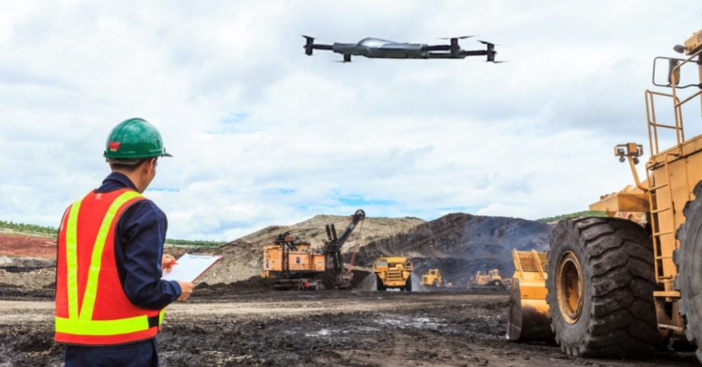
Drone Surveying for Mining Exploration
Another commendable advanced technique for mining surveying is the utilization of drone technology. It is a new and exciting technology rapidly becoming popular in the mining industry. Using drones makes it possible to quickly and cheaply map large land areas and accurately identify ore bodies, faults, and other features of interest. It also has the advantage of being less intrusive than other methods, such as aerial LiDAR or satellite imagery. It is ideal for mineral exploration activities in remote or sensitive locations. Here are some of the uses of drone solutions that give significant advantages to mining companies.
1: It supports site mapping
Drones technology can capture high-resolution images and video of a mine site to create detailed maps for exploration activities and resource management projects. With the right drone technology, surveyors can also take more footages as much as they can. That way, they can produce a better mapping of the area.
2: It can monitor environmental changes
Monitoring the environment before, during, and after the mining activities is essential. Drone surveys can make environmental monitoring accessible and cost-effective. It allows mining companies to take their jobs responsibly by identifying situations like land reclamation and land degradation. And with drone solutions, regular monitoring can be more manageable than ever.
3: It is suitable for orebody mapping
Drones technology can take aerial mapping for ore bodies with precision. It can provide data for resource estimation and mine planning activities in the most time-efficient and safer way. The multispectral sensors and the ability for remote surveying can help miners do the job faster yet still more efficiently.
4: It aids mining inspections
Drones can easily access hard-to-reach mine site areas, making it easier to inspect infrastructure, equipment, and other structures for safety. It is an efficient solution to keep surveyors safe as possible.
5: It tightens area security
Drones are also commendable for perimeter monitoring of the mine site. The sensors and high-quality cameras can help detect any unauthorized intrusions or breaches in security. Hence, it improves the existing security.
Takeaway
Mining surveying is a crucial task that makes exploration and extracting successful. The different surveying technique allows mining companies to make their operations accurate and less risky. And from traditional and high-technology surveying approaches, a drone solution can aid this job in the most cost and time-efficient way.
Contact Us
Thank you for your message. It has been sent.